
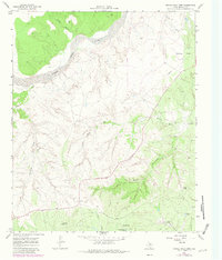
1967 Map of Turtle Hole Camp
USGS Topo · Published 1969About this map
The North Pease River dominates this landscape in Motley County, carving through the high plains of the Texas Panhandle. This mid-century survey reveals a ranching economy defined by water management, where named windmills like Red Windmill, Berryman Windmill, and Oil Well Windmill serve as essential landmarks across the broken terrain. The presence of Turtle Hole Camp and Lucky Knob Camp suggests seasonal or specialized cattle operations near the rugged breaks of Dikes Canyon and South Canyon.
Find a feature on this map
19 named features on this map. Tap any name to fly to it.
Don’t see what you’re looking for? This feature index may not catch every label — zoom into the map to look around manually.
Map Details
Editions of this 1967 Turtle Hole Camp Map
2 editions found
Other maps of this area

1954 · Plainview
USGS Topo · 1:250,000

1958 · Plainview
USGS Topo · 1:250,000

1966 · Fields Canyon
USGS Topo · 1:24,000

1966 · Matador
USGS Topo · 1:24,000

1966 · Ballard Camp
USGS Topo · 1:24,000

1966 · Tee Pee City
USGS Topo · 1:24,000

1967 · North Windmill
USGS Topo · 1:24,000

1967 · Cottonwood Camp
USGS Topo · 1:24,000

1967 · Hornica Creek
USGS Topo · 1:24,000

1967 · Northfield
USGS Topo · 1:24,000