
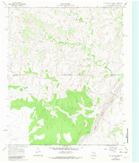
1967 Map of Cottonwood Camp
USGS Topo · Published 1969About this map
Ranching outposts and water sources define this 1960s landscape along the boundary of Hall and Motley Counties. The North Pease River cuts through the southeastern corner, while the Wind River and Cottonwood Creek meander across the northern half. This territory is marked by several named camps, including Cottonwood Camp, Wind River Camp, and Cedar Top Camp, indicating a structured system of land management and livestock operations in the Rolling Plains region.
Find a feature on this map
23 named features on this map. Tap any name to fly to it.
Don’t see what you’re looking for? This feature index may not catch every label — zoom into the map to look around manually.
Map Details
Editions of this 1967 Cottonwood Camp Map
2 editions found
Other maps of this area

1954 · Plainview
USGS Topo · 1:250,000

1958 · Plainview
USGS Topo · 1:250,000

1966 · Fields Canyon
USGS Topo · 1:24,000

1967 · North Windmill
USGS Topo · 1:24,000

1967 · Tampico Siding
USGS Topo · 1:24,000

1967 · Badger Nest Tank
USGS Topo · 1:24,000

1967 · Hornica Creek
USGS Topo · 1:24,000

1967 · Turtle Hole Camp
USGS Topo · 1:24,000

1967 · Northfield
USGS Topo · 1:24,000

1967 · Blue Tank Canyon
USGS Topo · 1:24,000