
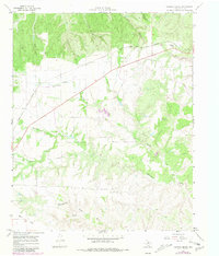
1967 Map of Tampico Siding
USGS Topo · Published 1969About this map
The Fort Worth And Denver railroad cuts a diagonal path across this Hall County landscape, serving the remote Tampico Siding in the late 1960s. The terrain is defined by an intricate network of erosional features, where the Wind River and Buffalo Creek have carved deep into the plains. These waterways are joined by numerous named draws and canyons, such as Chinaberry Draw, Mullin Canyon, and T Bar Canyon, illustrating the high-relief topography characteristic of the Texas Panhandle's canyonlands. Small-scale industry is present in the form of a Gravel Pit, while broader landmarks like Wolf Flat and Mockingbird Draw provide specific points of reference for local history and genealogy. The map details a transition from the structured railway corridor to the wilder, deeply dissected breaks of Cottonwood Creek and its many tributaries.
Find a feature on this map
16 named features on this map. Tap any name to fly to it.
Don’t see what you’re looking for? This feature index may not catch every label — zoom into the map to look around manually.
Map Details
Editions of this 1967 Tampico Siding Map
2 editions found
Other maps of this area

1954 · Plainview
USGS Topo · 1:250,000

1958 · Plainview
USGS Topo · 1:250,000

1960 · Brice
USGS Topo · 1:62,500

1961 · Memphis
USGS Topo · 1:62,500

1967 · North Windmill
USGS Topo · 1:24,000

1967 · Cottonwood Camp
USGS Topo · 1:24,000

1967 · Turkey
USGS Topo · 1:24,000

1967 · Blue Tank Canyon
USGS Topo · 1:24,000
1967 · Folley
USGS Topo · 1:24,000

1976 · Brice SE
USGS Topo · 1:24,000