
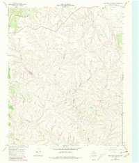
1967 Map of Blue Tank Canyon
USGS Topo · Published 1970About this map
The Fort Worth and Denver railroad cuts across the northern edge of this Hall County landscape, providing a vital connection for the small settlement of Parnell. This 1967 survey reveals a terrain deeply etched by drainage systems, where Blue Tank Canyon and Deer Spring Canyon converge in a complex network of breaks and draws typical of the Texas Panhandle. The map documents a sparsely populated ranching environment, noted by the presence of Mill Iron and numerous red dashed lines indicating property fence lines. Seasonal watercourses like Cottonwood Creek and Bullard Creek define the local topography, while numerous private tracks wind through the canyons to reach remote areas such as T Bar Canyon and East T Bar Canyon. The sparse distribution of named points highlights the isolation of these rural Texas holdings during the mid-20th century.
Find a feature on this map
10 named features on this map. Tap any name to fly to it.
Don’t see what you’re looking for? This feature index may not catch every label — zoom into the map to look around manually.
Map Details
Editions of this 1967 Blue Tank Canyon Map
2 editions found
Other maps of this area

1954 · Plainview
USGS Topo · 1:250,000

1958 · Plainview
USGS Topo · 1:250,000

1960 · Brice
USGS Topo · 1:62,500

1961 · Memphis
USGS Topo · 1:62,500

1967 · North Windmill
USGS Topo · 1:24,000

1967 · Cottonwood Camp
USGS Topo · 1:24,000

1967 · Tampico Siding
USGS Topo · 1:24,000

1967 · Badger Nest Tank
USGS Topo · 1:24,000

1967 · Northfield
USGS Topo · 1:24,000

1976 · Brice SE
USGS Topo · 1:24,000