
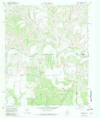
1967 Map of Northfield
USGS Topo · Published 1969About this map
Northfield sits as a quiet hub in this West Texas landscape, where the North Pease River carves a wide, braided path through the plains of the Panhandle. The map reveals a complex system of drainage and erosion, with prominent features like Cheney Mountain Creek, Price Canyon, and the deeply incised Housetop Canyon feeding into the main river valley. This 1967 field survey captures the intersection of three counties, marked by an indefinite boundary line that follows the river's course between the Hall, Motley, and Cottle county lines. The land use here is defined by cattle ranching and early petroleum exploration, evidenced by the numerous fence lines and a lonely Oil Well near Poker Canyon. Small water features like Lake Joe and the winding Bitter Creek provide essential resources in a region dominated by its dramatic topographic relief, including Cheney Mountain to the north.
Find a feature on this map
15 named features on this map. Tap any name to fly to it.
Don’t see what you’re looking for? This feature index may not catch every label — zoom into the map to look around manually.
Map Details
Editions of this 1967 Northfield Map
2 editions found
Other maps of this area

1954 · Plainview
USGS Topo · 1:250,000

1958 · Plainview
USGS Topo · 1:250,000

1966 · Fields Canyon
USGS Topo · 1:24,000

1966 · Cee Vee
USGS Topo · 1:24,000

1967 · Tell South
USGS Topo · 1:24,000

1967 · Tell North
USGS Topo · 1:24,000

1967 · Cottonwood Camp
USGS Topo · 1:24,000

1967 · Badger Nest Tank
USGS Topo · 1:24,000

1967 · Turtle Hole Camp
USGS Topo · 1:24,000

1967 · Blue Tank Canyon
USGS Topo · 1:24,000