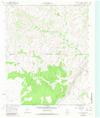
1967 Map of Cottonwood Camp
USGS Topo · Published 1981About this map
Water sources dictate the landscape of this portion of the Texas Panhandle, where the North Pease River and Wind River carve through the arid terrain of Hall and Motley counties. Ranching infrastructure is the primary mark of human activity, defined by a network of isolated outposts like Cottonwood Camp, Wind River Camp, and the Turkey Creek Ranch.
Find a feature on this map
21 named features on this map. Tap any name to fly to it.
Don’t see what you’re looking for? This feature index may not catch every label — zoom into the map to look around manually.
Map Details
Editions of this 1967 Cottonwood Camp Map
2 editions found
Other maps of this area

1954 · Plainview
USGS Topo · 1:250,000

1958 · Plainview
USGS Topo · 1:250,000

1966 · Fields Canyon
USGS Topo · 1:24,000

1967 · North Windmill
USGS Topo · 1:24,000

1967 · Cottonwood Camp
USGS Topo · 1:24,000

1967 · Tampico Siding
USGS Topo · 1:24,000

1967 · Badger Nest Tank
USGS Topo · 1:24,000

1967 · Hornica Creek
USGS Topo · 1:24,000

1967 · Turtle Hole Camp
USGS Topo · 1:24,000

1967 · Northfield
USGS Topo · 1:24,000