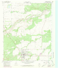
1966 Map of Matador
USGS Topo · Published 1981About this map
Matador serves as the focal point of this Motley County landscape, situated where the high plains begin to break toward the drainage of the Middle Pease River. The town grid is clearly defined, showing the distribution of local infrastructure including a Radio Tower and a substation at the southwestern edge. To the east of the primary settlement lies East Mound Cemetery, providing a key point of interest for genealogists and local historians tracking the early residents of this Texas panhandle community.
Find a feature on this map
10 named features on this map. Tap any name to fly to it.
Don’t see what you’re looking for? This feature index may not catch every label — zoom into the map to look around manually.
Map Details
Editions of this 1966 Matador Map
2 editions found
Other maps of this area

1954 · Lubbock
USGS Topo · 1:250,000

1954 · Plainview
USGS Topo · 1:250,000

1958 · Plainview
USGS Topo · 1:250,000

1966 · Matador
USGS Topo · 1:24,000

1966 · Ballard Camp
USGS Topo · 1:24,000

1967 · Hornica Creek
USGS Topo · 1:24,000

1967 · Turtle Hole Camp
USGS Topo · 1:24,000

1967 · Flomot
USGS Topo · 1:24,000

1967 · Whiteflat
USGS Topo · 1:24,000

1968 · Mac Bain
USGS Topo · 1:24,000