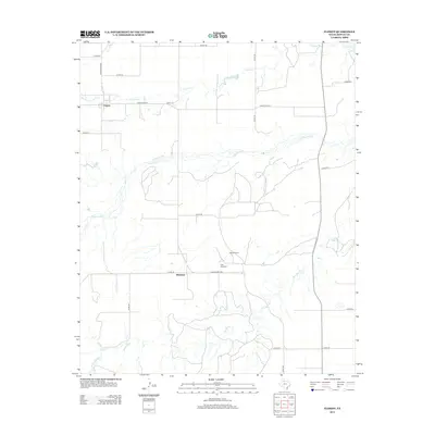
2012 Map of Flomot
USGS Topo · Published 2012About this map
Flomot sits at the northern edge of this West Texas survey, where the high plains begin to break toward the canyonlands of the Rolling Plains. The landscape is defined by the drainage systems of the N Pease River and Alamosa Cr, which create a network of draws and breaks across the ranchland. To the south, the small community of Whitestar is situated near the upper reaches of Tom Ball Cr. The map captures a rural infrastructure dictated by water and topography, evidenced by landmarks like Twin Windmill and West Windmill that dot the expansive properties between the county roads. The winding course of the North Pease River dominates the central portion of the sheet, illustrating the transition from flat cotton and cattle country into the more varied terrain of the Pease River valley.
Find a feature on this map
25 named features on this map. Tap any name to fly to it.
Don’t see what you’re looking for? This feature index may not catch every label — zoom into the map to look around manually.
Map Details
Editions of this 2012 Flomot Map
This is the sole edition of this map. No revisions or reprints were ever made.
Other maps of this area

1954 · Plainview
USGS Topo · 1:250,000

1958 · Plainview
USGS Topo · 1:250,000

1966 · Matador
USGS Topo · 1:24,000

1967 · Quitaque
USGS Topo · 1:24,000

1967 · North Windmill
USGS Topo · 1:24,000

1967 · Quitaque Peaks
USGS Topo · 1:24,000

1967 · Dick Moore Canyon
USGS Topo · 1:24,000

1967 · Hornica Creek
USGS Topo · 1:24,000

1967 · Flomot
USGS Topo · 1:24,000

1967 · Whiteflat
USGS Topo · 1:24,000