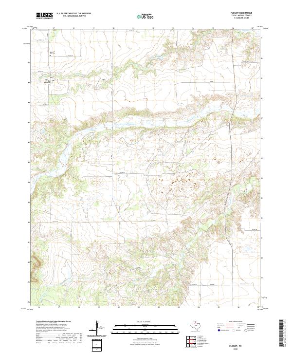
2022 Map of Flomot
USGS Topo · Published 2022About this map
Flomot serves as the primary settlement in this corner of Motley County, where the plains give way to the drainage systems of the Rolling Plains. The local geography is defined by the N Pease River, which cuts a wide path across the center of the quadrangle. North of the river, Alamosa Cr and Quitaque Cr carve into the terrain, while the southern portion is marked by the winding course of Tom Ball Cr and the presence of Miller Springs. For those tracing local history, the Memorial Park Cem and the central Po in Flomot offer specific points of interest. The map shows a landscape organized by a network of farm-to-market roads and county routes, including FM 97 and FM 2009, which connect the scattered ranching and agricultural interests to the community hub.
Find a feature on this map
21 named features on this map. Tap any name to fly to it.
Don’t see what you’re looking for? This feature index may not catch every label — zoom into the map to look around manually.
Map Details
Editions of this 2022 Flomot Map
This is the sole edition of this map. No revisions or reprints were ever made.
Other maps of this area

1954 · Plainview
USGS Topo · 1:250,000

1958 · Plainview
USGS Topo · 1:250,000

1966 · Matador
USGS Topo · 1:24,000

1967 · Quitaque
USGS Topo · 1:24,000

1967 · North Windmill
USGS Topo · 1:24,000

1967 · Quitaque Peaks
USGS Topo · 1:24,000

1967 · Dick Moore Canyon
USGS Topo · 1:24,000

1967 · Hornica Creek
USGS Topo · 1:24,000

1967 · Flomot
USGS Topo · 1:24,000

1967 · Whiteflat
USGS Topo · 1:24,000