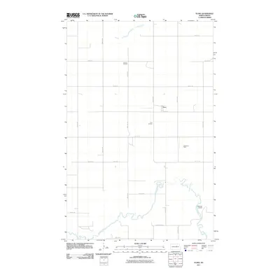
2011 Map of Flora
USGS Topo · Published 2011About this map
Flora sits in the heart of this Benson County landscape, where the prairie is etched by the winding course of the Sheyenne River. This survey captures the rural character of the region, defined by a rigid grid of agricultural roads like 37th St NE and County Rd-0319 that segment the plains. The presence of both the Maddock Cemetery and Flora Cemetery provides essential data for genealogists tracing families in this part of North Dakota. To the east, the terrain descends toward Peterson Coulee, a natural drainage feature that contrasts with the surrounding flat agricultural land. The map also identifies Gilbertson Field, illustrating the localized land use and landmarks important to the community during this era of modern mapping.
Find a feature on this map
16 named features on this map. Tap any name to fly to it.
Don’t see what you’re looking for? This feature index may not catch every label — zoom into the map to look around manually.
Map Details
Editions of this 2011 Flora Map
This is the sole edition of this map. No revisions or reprints were ever made.
Other maps of this area

1932 · Flora
USGS Topo · 1:62,500

1943 · Maddock
USGS Topo · 1:62,500

1945 · Maddock
USGS Topo · 1:62,500

1951 · Flora SE
USGS Topo · 1:24,000

1951 · Black Hammer Hill
USGS Topo · 1:24,000

1951 · Flora
USGS Topo · 1:24,000

1951 · Josephine
USGS Topo · 1:24,000

1951 · Maddock
USGS Topo · 1:24,000
1951 · Hamberg
USGS Topo · 1:24,000

1951 · Flora
USGS Topo · 1:62,500