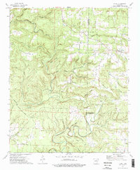
1973 Map of Floral
USGS Topo · Published 1975About this map
The settlement of Floral serves as the primary landmark in this 1973 survey of the tri-county borderlands where Cleburne, Independence, and White counties meet. The landscape is defined by the sharp topographic relief of Warren Mountain and Bailey Mountain, with the rural community pattern reflected in numerous family cemeteries and small country churches. Genealogists will find significant value in the documentation of the Warren Cem, Bailey Cem, and Burkett Cem, alongside houses of worship such as Banner Ch and Pine Grove Ch. A complex drainage network including Wagon Wheel Creek, Elbow Creek, and South Fork Big Creek cuts through the ridges. The presence of a prominent Pipeline crossing the eastern half of the map marks a modern industrial layer over the traditional Ozark upland landscape of Bear Ridge and Churchill Ridge.
Find a feature on this map
42 named features on this map. Tap any name to fly to it.
Don’t see what you’re looking for? This feature index may not catch every label — zoom into the map to look around manually.
Map Details
Editions of this 1973 Floral Map
2 editions found
Other maps of this area

1890 · Batesville
USGS Topo · 1:125,000

1891 · Batesville
USGS Topo · 1:125,000

1935 · Bald Knob
USGS Topo · 1:62,500

1942 · Jamestown
USGS Topo · 1:31,680

1942 · Almond
USGS Topo · 1:31,680

1953 · Memphis
USGS Topo · 1:250,000

1956 · Memphis
USGS Topo · 1:250,000

1962 · Pangburn
USGS Topo · 1:24,000

1963 · West Pangburn
USGS Topo · 1:24,000

1965 · Pleasant Plains
USGS Topo · 1:24,000