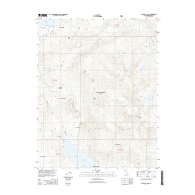
2015 Map of Florence Lake
USGS Topo · Published 2015About this map
Sierra National Forest surrounds this high-elevation landscape in the Sierra Nevada range, dominated by massive granite formations and subalpine lakes. The central hydrology is defined by the S Fork San Joaquin River and the artificial reservoirs of Florence Lake and Lake Thomas A Edison, which are connected by the subterranean Ward Tunnel. This engineering feat illustrates the complex water management systems developed in Fresno County.
Find a feature on this map
55 named features on this map. Tap any name to fly to it.
Don’t see what you’re looking for? This feature index may not catch every label — zoom into the map to look around manually.
Map Details
Editions of this 2015 Florence Lake Map
This is the sole edition of this map. No revisions or reprints were ever made.
Other maps of this area

1904 · Kaiser
USGS Topo · 1:125,000

1912 · Mt. Goddard
USGS Topo · 1:125,000

1947 · Mariposa
USGS Topo · 1:250,000

1948 · Mariposa
USGS Topo · 1:250,000

1953 · Mt Abbot
USGS Topo · 1:62,500

1953 · Huntington Lake
USGS Topo · 1:62,500

1953 · Blackcap Mtn
USGS Topo · 1:62,500

1953 · Kaiser Peak
USGS Topo · 1:62,500

1957 · Mariposa
USGS Topo · 1:250,000
1962 · Blackcap Mtn
USGS Topo · 1:62,500