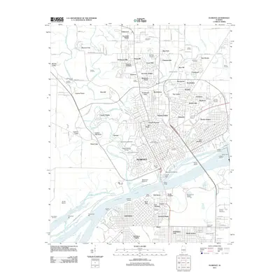
2011 Map of Florence
USGS Topo · Published 2011About this map
Florence and its surrounding suburbs dominate this landscape along the northern banks of the Tennessee River during the early 21st century. The map illustrates a dense network of residential developments, from Cloverdale Heights in the north to the industrialized riverfront. Significant academic and cultural landmarks are evident, most notably the University of North Alabama and the ancient Waumanona Mound near the riverbank. The river itself is a focal point of activity, featuring the Florence State Dock and the massive Wilson Dam structure to the east.
Find a feature on this map
186 named features on this map. Tap any name to fly to it.
Don’t see what you’re looking for? This feature index may not catch every label — zoom into the map to look around manually.
Map Details
Editions of this 2011 Florence Map
This is the sole edition of this map. No revisions or reprints were ever made.
Other maps of this area

1914 · Muscle Shoals
USGS Topo · 1:48,000

1916 · Muscle Shoals
USGS Topo · 1:62,500

1924 · Tuscumbia
USGS Topo · 1:48,000

1924 · Gravelly Springs
USGS Topo · 1:48,000

1925 · Barton
USGS Topo · 1:62,500

1926 · Tuscumbia
USGS Topo · 1:62,500

1926 · Barton
USGS Topo · 1:48,000

1926 · Gravelly Springs
USGS Topo · 1:62,500

1929 · Barton
USGS Topo · 1:62,500

1936 · Pride
USGS Topo · 1:24,000