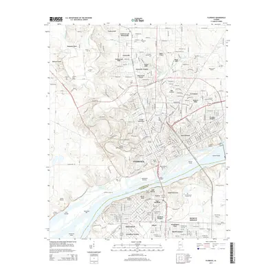
2014 Map of Florence
USGS Topo · Published 2014About this map
Florence and Sheffield anchor this 2014 survey of the Tennessee River corridor, illustrating the dense suburban development and industrial footprint across the Lauderdale and Colbert County line. The map captures the significant academic presence of the University of North Alabama and Heritage Christian University, alongside cultural landmarks like the Waumanona Mound near the riverbanks. The waterway itself is defined by major navigational features including Pickwick Lake, Wilson Lake, and the expansive Sevenmile Island. For local historians and genealogists, the map provides precise locations for numerous community burial grounds, such as Mt Calvary Cemetery, Underwood Cemetery, and the large Florence Cemetery. The landscape transitions from the developed streets of East Florence and South Florence to the natural springs and hollows like Stewart Spring Hollow and Beaver Dam Creek Springs.
Find a feature on this map
296 named features on this map. Tap any name to fly to it.
Don’t see what you’re looking for? This feature index may not catch every label — zoom into the map to look around manually.
Map Details
Editions of this 2014 Florence Map
This is the sole edition of this map. No revisions or reprints were ever made.
Other maps of this area

1914 · Muscle Shoals
USGS Topo · 1:48,000

1916 · Muscle Shoals
USGS Topo · 1:62,500

1924 · Tuscumbia
USGS Topo · 1:48,000

1924 · Gravelly Springs
USGS Topo · 1:48,000

1925 · Barton
USGS Topo · 1:62,500

1926 · Tuscumbia
USGS Topo · 1:62,500

1926 · Barton
USGS Topo · 1:48,000

1926 · Gravelly Springs
USGS Topo · 1:62,500

1929 · Barton
USGS Topo · 1:62,500

1936 · Pride
USGS Topo · 1:24,000