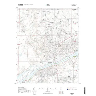
2018 Map of Florence
USGS Topo · Published 2018About this map
Florence and Sheffield sit divided by the Tennessee River, anchoring a region defined by industrial waterways and deep local history. In the heart of Florence, the University of North Alabama and the ancient Waumanona Mound overlook the river valley, while the O'Neal Bridge provides a primary transit link between the Lauderdale and Colbert county shores. The river itself is a complex network of channels and landmarks, including Patton Island, Sevenmile Island, and the expansive McFarland Bottoms.
Find a feature on this map
77 named features on this map. Tap any name to fly to it.
Don’t see what you’re looking for? This feature index may not catch every label — zoom into the map to look around manually.
Map Details
Editions of this 2018 Florence Map
This is the sole edition of this map. No revisions or reprints were ever made.
Other maps of this area

1914 · Muscle Shoals
USGS Topo · 1:48,000

1916 · Muscle Shoals
USGS Topo · 1:62,500

1924 · Tuscumbia
USGS Topo · 1:48,000

1924 · Gravelly Springs
USGS Topo · 1:48,000

1925 · Barton
USGS Topo · 1:62,500

1926 · Tuscumbia
USGS Topo · 1:62,500

1926 · Barton
USGS Topo · 1:48,000

1926 · Gravelly Springs
USGS Topo · 1:62,500

1929 · Barton
USGS Topo · 1:62,500

1936 · Pride
USGS Topo · 1:24,000