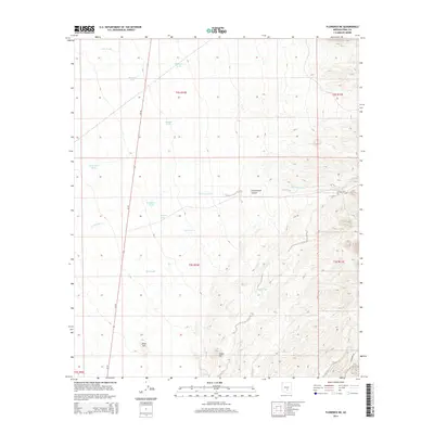
2014 Map of Florence NE
USGS Topo · Published 2014About this map
Cottonwood Canyon and the seasonal drainages of Magma Wash carve through this section of Pinal County, where the landscape is defined by its water management history. In an area dominated by dry washes like Cottonwood Cr, the distribution of man-made water sources points to the region's ranching heritage. Several significant catchment features, including Mormon Tank, Deep Well Tank, and Superior Tank, are strategically placed across the terrain to sustain livestock. The topography is anchored by prominent landmarks such as Black Hill and Dozer Hill, while the north-south corridor of Az-79 provides the primary transit link through this desert environment. This survey captures the essential infrastructure of a land where survival depends on the careful collection of surface runoff in the shadow of the nearby mountains.
Find a feature on this map
21 named features on this map. Tap any name to fly to it.
Don’t see what you’re looking for? This feature index may not catch every label — zoom into the map to look around manually.
Map Details
Editions of this 2014 Florence NE Map
This is the sole edition of this map. No revisions or reprints were ever made.
Other maps of this area

1900 · Florence
USGS Topo · 1:125,000

1902 · Florence
USGS Topo · 1:125,000

1948 · Superior
USGS Topo · 1:62,500

1948 · Picketpost Mtn
USGS Topo · 1:24,000

1949 · Picketpost Mtn
USGS Topo · 1:24,000

1954 · Mesa
USGS Topo · 1:250,000

1956 · Magma
USGS Topo · 1:24,000
1956 · Superstition Mts. SW
USGS Topo · 1:24,000

1957 · Mesa
USGS Topo · 1:250,000

1958 · Mesa
USGS Topo · 1:250,000