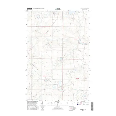
2015 Map of Florence SE
USGS Topo · Published 2015About this map
The Pine River and its controlled waters dominate this Florence County landscape, most notably where the Pine River Flowage spreads across the eastern sections. The hydrography of the region is further defined by a high concentration of glacial lakes, including Sea Lion Lake, Emily Lake, and the distinctly named Buckskin Lake. Local topography is highlighted by river features such as Pine Rapids and Popple Rapids, indicating the fluctuating elevation and water power that historically shaped the Northwoods development.
Find a feature on this map
76 named features on this map. Tap any name to fly to it.
Don’t see what you’re looking for? This feature index may not catch every label — zoom into the map to look around manually.
Map Details
Editions of this 2015 Florence SE Map
This is the sole edition of this map. No revisions or reprints were ever made.
Other maps of this area

1939 · Dunbar
USGS Topo · 1:48,000

1939 · Goodman
USGS Topo · 1:48,000

1939 · Iron Mountain
USGS Topo · 1:48,000

1941 · Florence
USGS Topo · 1:48,000

1941 · Dunbar
USGS Topo · 1:48,000

1941 · Iron Mountain
USGS Topo · 1:48,000

1946 · Goodman
USGS Topo · 1:48,000

1947 · Naults
USGS Topo · 1:24,000

1947 · Dunbar
USGS Topo · 1:48,000

1947 · Iron Mountain
USGS Topo · 1:48,000