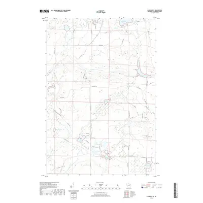
2018 Map of Florence SE
USGS Topo · Published 2018About this map
The Pine River and Popple River dominate this landscape in Florence County, carving through a region defined by extensive glacial water bodies and significant river features. Notable water-level changes are evident at Pine River Flowage and the turbulent stretches of Pine Rapids and Popple Rapids. This northern Wisconsin terrain is characterized by a dense network of lakes, from the large Emily Lake in the north to the cluster including West Bass Lake, Mirror Lake, and Bass Lake further south.
Find a feature on this map
70 named features on this map. Tap any name to fly to it.
Don’t see what you’re looking for? This feature index may not catch every label — zoom into the map to look around manually.
Map Details
Editions of this 2018 Florence SE Map
This is the sole edition of this map. No revisions or reprints were ever made.
Other maps of this area

1939 · Dunbar
USGS Topo · 1:48,000

1939 · Goodman
USGS Topo · 1:48,000

1939 · Iron Mountain
USGS Topo · 1:48,000

1941 · Florence
USGS Topo · 1:48,000

1941 · Dunbar
USGS Topo · 1:48,000

1941 · Iron Mountain
USGS Topo · 1:48,000

1946 · Goodman
USGS Topo · 1:48,000

1947 · Naults
USGS Topo · 1:24,000

1947 · Dunbar
USGS Topo · 1:48,000

1947 · Iron Mountain
USGS Topo · 1:48,000