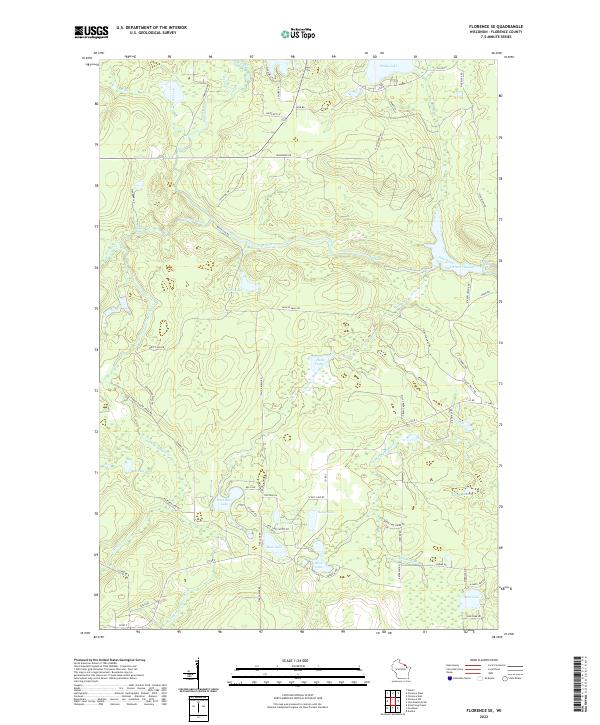
2022 Map of Florence SE
USGS Topo · Published 2022About this map
The Pine River and its numerous rapids and falls define this north-woods landscape in southeastern Florence County. The river's course is punctuated by the Pine River Flowage and the dramatic drop at Breakwater Falls, reflecting the area's hydroelectric history and managed water levels. The surrounding forest is crisscrossed by specialized access roads like Hills Creek Dam Rd and River Flowage Rd, indicating the importance of water management and timber infrastructure in this region.
Find a feature on this map
76 named features on this map. Tap any name to fly to it.
Don’t see what you’re looking for? This feature index may not catch every label — zoom into the map to look around manually.
Map Details
Editions of this 2022 Florence SE Map
This is the sole edition of this map. No revisions or reprints were ever made.
Other maps of this area

1939 · Dunbar
USGS Topo · 1:48,000

1939 · Goodman
USGS Topo · 1:48,000

1939 · Iron Mountain
USGS Topo · 1:48,000

1941 · Florence
USGS Topo · 1:48,000

1941 · Dunbar
USGS Topo · 1:48,000

1941 · Iron Mountain
USGS Topo · 1:48,000

1946 · Goodman
USGS Topo · 1:48,000

1947 · Naults
USGS Topo · 1:24,000

1947 · Dunbar
USGS Topo · 1:48,000

1947 · Iron Mountain
USGS Topo · 1:48,000