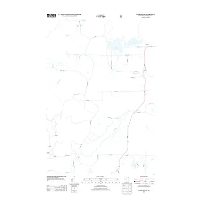
2013 Map of Florence SW
USGS Topo · Published 2013About this map
Fern sits as the primary settlement hub in this northern Wisconsin woodland, situated along the north-south axis of Town Hall Rd. The landscape is defined by its extensive drainage network, where the Popple River winds through the southern reaches, fed by numerous tributaries including Hendricks Cr and Lund Cr. In the northern section, Patten Lake and Price Lake serve as prominent anchors for local travel, connected by a web of timber-focused routes such as Norway Pine Ln and Patten Lake Rd. This map reflects the remote character of Florence County, where the road network, including Rock Creek Rd and Grade Rd, primarily follows the natural contours of the watersheds. The density of named creeks like Woods Cr and Haymarsh Cr highlights a terrain deeply interconnected by small waterways and wetlands, characteristic of the Northwoods before the heavy modern development seen in more southern regions.
Find a feature on this map
37 named features on this map. Tap any name to fly to it.
Don’t see what you’re looking for? This feature index may not catch every label — zoom into the map to look around manually.
Map Details
Editions of this 2013 Florence SW Map
This is the sole edition of this map. No revisions or reprints were ever made.
Other maps of this area

1939 · Goodman
USGS Topo · 1:48,000

1939 · Laona
USGS Topo · 1:48,000

1939 · Long Lake
USGS Topo · 1:48,000

1941 · Florence
USGS Topo · 1:48,000

1946 · Laona
USGS Topo · 1:48,000

1946 · Goodman
USGS Topo · 1:48,000

1947 · Naults
USGS Topo · 1:24,000

1947 · Stager
USGS Topo · 1:24,000

1948 · Long Lake
USGS Topo · 1:48,000

1954 · Iron Mountain
USGS Topo · 1:250,000