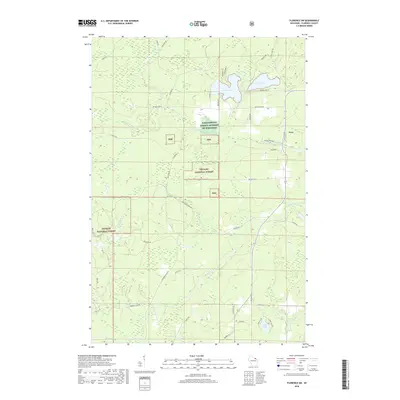
2018 Map of Florence SW
USGS Topo · Published 2018About this map
The Nicolet National Forest dominates this northern Wisconsin landscape, where the settlement of Fern sits along Town Hall Rd. The terrain is defined by a dense network of timber-access routes and water features, including the Popple River and several significant lakes such as Patten Lake, Price Lake, and Haley Lake. Traces of the region's logging and conservation history are evident in the naming of roads like Goodman Grade Rd and Grade Rd, which often follow the paths of former narrow-gauge railway beds used for extraction. The presence of the Farm Service Agency Interest of Wisconsin land reflects ongoing federal management within the forest boundaries. In the southern portion of the quadrangle, the landscape transitions toward the drainage of Lund Cr and Lund Lake, connected by locally named corridors like Morgan Lake Rd.
Find a feature on this map
48 named features on this map. Tap any name to fly to it.
Don’t see what you’re looking for? This feature index may not catch every label — zoom into the map to look around manually.
Map Details
Editions of this 2018 Florence SW Map
This is the sole edition of this map. No revisions or reprints were ever made.
Other maps of this area

1939 · Goodman
USGS Topo · 1:48,000

1939 · Laona
USGS Topo · 1:48,000

1939 · Long Lake
USGS Topo · 1:48,000

1941 · Florence
USGS Topo · 1:48,000

1946 · Laona
USGS Topo · 1:48,000

1946 · Goodman
USGS Topo · 1:48,000

1947 · Naults
USGS Topo · 1:24,000

1947 · Stager
USGS Topo · 1:24,000

1948 · Long Lake
USGS Topo · 1:48,000

1954 · Iron Mountain
USGS Topo · 1:250,000