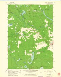
1962 Map of Florence West
USGS Topo · Published 1964About this map
The Brule River and Paint River carve through this Northwoods borderland, defining the boundary between Michigan and Wisconsin. In the early 1960s, the landscape reflects a transition from the industrial legacy of the Iron Range to a region of forest management and recreation. The Chicago and North Western railroad cuts a diagonal path across the terrain, connecting the small settlement of Florence with outlying points like Tyran and Ridgetop.
Find a feature on this map
40 named features on this map. Tap any name to fly to it.
Don’t see what you’re looking for? This feature index may not catch every label — zoom into the map to look around manually.
Map Details
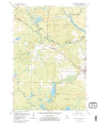
Editions of this 1962 Florence West Map
2 editions found
Other maps of this area

1899 · Sagola
USGS Topo · 1:62,500

1899 · Crystal Falls
USGS Topo · 1:62,500

1939 · Iron Mountain
USGS Topo · 1:48,000

1941 · Florence
USGS Topo · 1:48,000

1941 · Iron Mountain
USGS Topo · 1:48,000

1944 · Crystal Falls
USGS Topo · 1:24,000

1944 · Fortune Lakes
USGS Topo · 1:24,000

1946 · Crystal Falls
USGS Topo · 1:31,680

1946 · Fortune Lakes
USGS Topo · 1:31,680

1947 · Naults
USGS Topo · 1:24,000