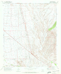
1969 Map of Flores
USGS Topo · Published 1972About this map
The Atchison Topeka and Santa Fe railroad cuts a straight diagonal through this Yavapai County landscape, providing a primary anchor for the small settlement of Flores. This late 1960s environment is defined by its water management and transit infrastructure, featuring the Moreton Airport and a network of water catchment systems like Martinez Tank, Big Tank, and Pits Tank. The terrain is shaped by the drainage patterns of Martinez Creek, Antelope Creek, and Weaver Creek, which flow toward the southern rises of Black Hill. Numerous named Jeep trails and footpaths suggest a landscape utilized for ranching or prospecting, connecting remote water sources across the arid washes. The layout of Soto Wash and Martinez Wash illustrates the natural hydrology that influenced the positioning of early regional infrastructure.
Find a feature on this map
18 named features on this map. Tap any name to fly to it.
Don’t see what you’re looking for? This feature index may not catch every label — zoom into the map to look around manually.
Map Details
Editions of this 1969 Flores Map
3 editions found
Other maps of this area

1887 · Prescott
USGS Topo · 1:250,000

1892 · Prescott
USGS Topo · 1:250,000

1903 · Congress
USGS Topo · 1:125,000

1904 · Congress
USGS Topo · 1:125,000

1947 · Wagoner
USGS Topo · 1:62,500

1948 · Wagoner
USGS Topo · 1:63,360

1950 · Wagoner
USGS Topo · 1:62,500

1950 · Prescott
USGS Topo · 1:250,000

1954 · Prescott
USGS Topo · 1:250,000

1954 · Phoenix
USGS Topo · 1:250,000