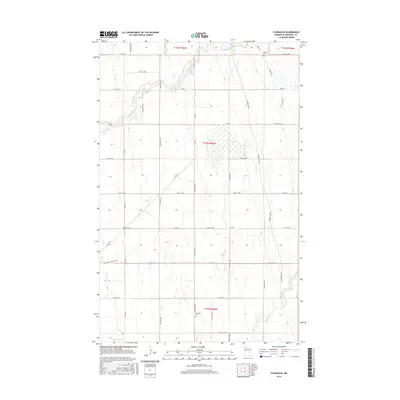
2016 Map of Florian SE
USGS Topo · Published 2016About this map
The Middle River meanders across this section of Marshall County, defining a landscape traditionally dominated by agricultural townships. In the north, Foldahl Cem serves as a primary genealogical landmark near the intersection of Co Rd 114 and 340th St NW. The terrain is characterized by its drainage patterns, with Swift Coulee and the Snake River providing natural relief to the grid-based road network. Traces of the region's historic transportation routes are visible through the Pembina Trl, which cuts across several sections, including Pembina Trial and Pembina Trl NW. A second burial site, Township Cem, is located further south along 240th Ave NW. The map illustrates a rural environment where infrastructure is focused on connectivity between farmsteads, evidenced by the numerous numbered county highways and township roads that segment the prairie.
Find a feature on this map
40 named features on this map. Tap any name to fly to it.
Don’t see what you’re looking for? This feature index may not catch every label — zoom into the map to look around manually.
Map Details
Editions of this 2016 Florian SE Map
This is the sole edition of this map. No revisions or reprints were ever made.
Other maps of this area

1918 · Angus
USGS Topo · 1:62,500

1918 · Viking
USGS Topo · 1:62,500

1952 · Thief River Falls
USGS Topo · 1:250,000

1956 · Thief River Falls
USGS Topo · 1:250,000

1956 · Florian
USGS Topo · 1:62,500

1957 · Thief River Falls
USGS Topo · 1:250,000

1957 · Newfolden
USGS Topo · 1:62,500

1959 · Viking
USGS Topo · 1:24,000

1961 · Radium
USGS Topo · 1:24,000
1961 · Roan
USGS Topo · 1:24,000