
1946 Map of Florida
USGS Topo · Published 1946About this map
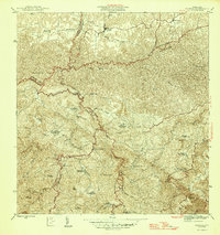
The town of Florida serves as a northern anchor for this mid-1940s landscape, which is defined by a dense network of traditional haciendas and winding mountain roads. The agricultural heritage of the region is evident in the numerous named estates such as Hacienda San José, Hacienda Piedra Gorda, and Hacienda Marqués, which dot the interior. These haciendas, many bearing family names, represent the established socio-economic structure of Puerto Rico's interior before the significant industrial shifts of the late 20th century.
Find a feature on this map
46 named features on this map. Tap any name to fly to it.
Don’t see what you’re looking for? This feature index may not catch every label — zoom into the map to look around manually.
Map Details
Editions of this 1946 Florida Map
3 editions found
Other maps of this area

1942 · Manati
USGS Topo · 1:30,000

1942 · Arecibo
USGS Topo · 1:30,000

1942 · Barceloneta
USGS Topo · 1:30,000

1943 · Utuado NE
USGS Topo · 1:10,000

1946 · Barceloneta
USGS Topo · 1:30,000

1946 · Utuado
USGS Topo · 1:30,000

1946 · Ciales
USGS Topo · 1:30,000

1946 · Jayuya
USGS Topo · 1:30,000

1946 · Arecibo
USGS Topo · 1:30,000

1946 · Manati
USGS Topo · 1:30,000