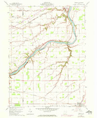
1959 Map of Florida
USGS Topo · Published 1972About this map
The Maumee River serves as the central artery of this Northwest Ohio landscape, winding past the village of Florida and providing the geographic backbone for local industry and transport. Parallel to its banks, the Miami and Erie Canal (Abandoned) remains a visible scar on the land, testifying to an earlier era of water-borne commerce before being superseded by the heavy rail lines that now cross the territory. The Norfolk and Western and Baltimore and Ohio railroads anchor settlements like Okolona and Holgate, while a network of rural routes such as Gerken Road and Weichman Road link family farmsteads. Local history is deeply etched into the countryside through numerous small burial grounds, including Huston Cem and Brinkman Cem, and community landmarks like Bethlehem Ch that served the surrounding townships of Adams and Flatrock.
Find a feature on this map
39 named features on this map. Tap any name to fly to it.
Don’t see what you’re looking for? This feature index may not catch every label — zoom into the map to look around manually.
Map Details
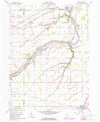
Editions of this 1959 Florida Map
3 editions found
Other maps of this area

1907 · Defiance
USGS Topo · 1:62,500

1908 · Ottawa
USGS Topo · 1:62,500

1908 · Napoleon
USGS Topo · 1:62,500

1909 · Defiance
USGS Topo · 1:62,500

1909 · Continental
USGS Topo · 1:62,500

1953 · Fort Wayne
USGS Topo · 1:250,000

1956 · Fort Wayne
USGS Topo · 1:250,000

1959 · Defiance East
USGS Topo · 1:24,000
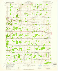
1959 · Ridgeville Corners
USGS Topo · 1:24,000

1959 · Florida
USGS Topo · 1:24,000