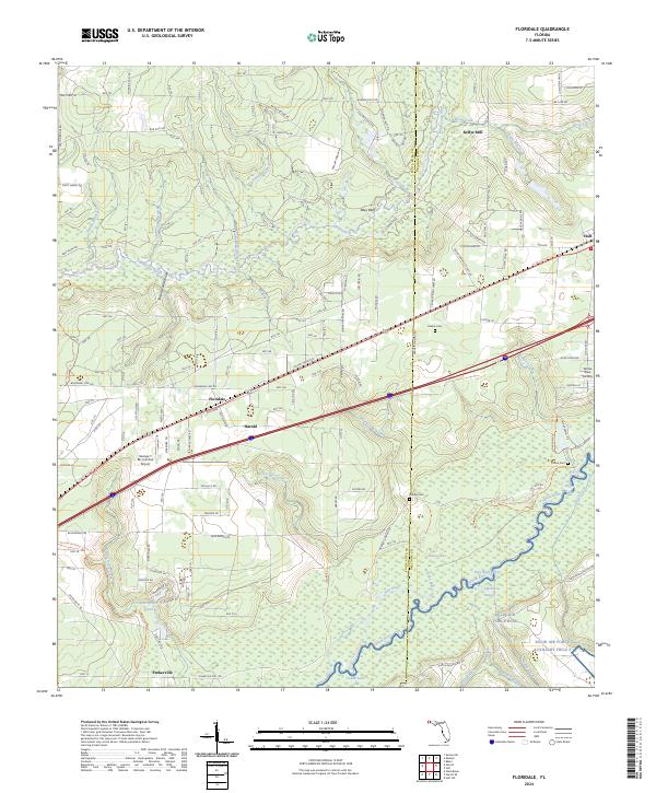
2024 Map of Floridale
USGS Topo · Published 2024About this map
Kellys Mill and the surrounding woodlands of northern Santa Rosa County are defined by a network of creeks and branches that feed into the Blackwater River and Yellow River. This landscape is marked by the presence of modern transportation and aviation infrastructure, with the George T McCutchan Airport and the Yellow River Airstrip serving the region alongside the major corridor of the Us 90 Connector Trl. Small settlements like Floridale, Harold, and Holt punctuate the map, while Parkerville sits at the southern edge near the winding Yellow River. Genealogy researchers will find several local landmarks, including Melvin Cem, Bishop Cem, and Canoe Cem. The southern portion of the quadrangle is occupied by Eglin Air Force Base, showing the convergence of military land use and protected natural areas like the Yellow River Water Management Area Trl.
Find a feature on this map
49 named features on this map. Tap any name to fly to it.
Don’t see what you’re looking for? This feature index may not catch every label — zoom into the map to look around manually.
Map Details
Editions of this 2024 Floridale Map
This is the sole edition of this map. No revisions or reprints were ever made.
Other maps of this area

1934 · Holt
USGS Topo · 1:48,000

1934 · Harold
USGS Topo · 1:62,500

1937 · Holt
USGS Topo · 1:62,500

1937 · Harold
USGS Topo · 1:62,500

1938 · Harold
USGS Topo · 1:62,500

1948 · Munson
USGS Topo · 1:62,500

1949 · Crestview
USGS Topo · 1:62,500

1950 · Munson
USGS Topo · 1:62,500

1951 · Crestview
USGS Topo · 1:62,500

1956 · Holt
USGS Topo · 1:62,500