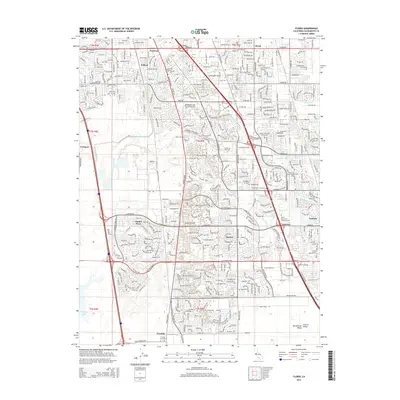
2015 Map of Florin
USGS Topo · Published 2015About this map
The Sacramento suburbs of Parkway and Laguna anchor this 2015 study of the evolving landscape south of the city center. This area is characterized by a dense network of residential streets and planned communities like Laguna West, woven around a complex system of drainage and waterways including Morrison Creek, Beacon Cr, and the branching Laguna Creek. To the east, major transit arteries like E Stockton Blvd and the Union Pacific rail corridor define the commercial and industrial layout of the region.
Find a feature on this map
45 named features on this map. Tap any name to fly to it.
Don’t see what you’re looking for? This feature index may not catch every label — zoom into the map to look around manually.
Map Details
Editions of this 2015 Florin Map
This is the sole edition of this map. No revisions or reprints were ever made.
Other maps of this area

1891 · Sacramento
USGS Topo · 1:125,000

1892 · Sacramento
USGS Topo · 1:125,000

1893 · Sacramento
USGS Topo · 1:125,000

1894 · Lodi
USGS Topo · 1:125,000

1902 · Fairoaks
USGS Topo · 1:62,500

1907 · Davisville
USGS Topo · 1:62,500

1908 · Courtland
USGS Topo · 1:62,500

1909 · Elk Grove
USGS Topo · 1:31,680

1909 · Florin
USGS Topo · 1:31,680

1910 · Bruceville
USGS Topo · 1:31,680