Loading...
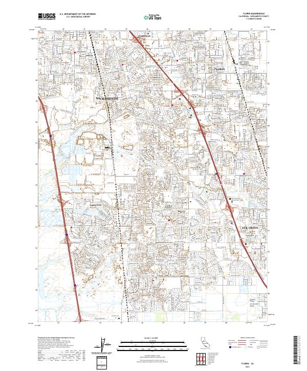
Loading map...2021 Map of Florin
USGS Topo · Published 2021About this map
The Central Valley landscape south of Sacramento reveals a dense network of suburban expansion and water management infrastructure at the start of the 2020s. Centered on the communities of Florin, Laguna, and Elk Grove, the terrain is defined by a complex grid of residential developments woven through a series of natural and modified watercourses, including Morrison Creek, Laguna Cr, and the prominent Sacramento Drainage Canal.
Find a feature on this map
36 named features on this map. Tap any name to fly to it.
Don’t see what you’re looking for? This feature index may not catch every label — zoom into the map to look around manually.
Map Details
Date Portrayed2021
Date Published2021
PublisherU.S. Geological Survey
Map TypeTopographic
Scale1:24000
Physical Dimensions24 x 29 inches
Editions of this 2021 Florin Map
This is the sole edition of this map. No revisions or reprints were ever made.
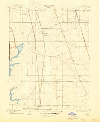
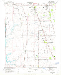
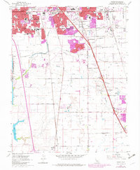
Historical Maps of Meadowview Through Time
4 maps found
Featured Locations
Source Details
SourceU.S. Geological Survey
CopyrightPublic Domain