
1973 Map of Floris
USGS Topo · Published 1976About this map
The small settlement of Floris sits at the northern edge of this Panhandle landscape, where the High Plains drop into the broad valley of the Beaver River. By the early 1970s, the region's economy was clearly defined by a dense network of energy extraction, with dozens of sites marked as Gas Well, Oil Well, and general Wells scattered across the township lines of Beaver North and Beaver South. This industrial presence is balanced by legacy agricultural holdings like the Blakemore Ranch and Willow Creek Ranch, reflecting the enduring cattle and ranching heritage of Beaver County.
Find a feature on this map
17 named features on this map. Tap any name to fly to it.
Don’t see what you’re looking for? This feature index may not catch every label — zoom into the map to look around manually.
Map Details
Editions of this 1973 Floris Map
This is the sole edition of this map. No revisions or reprints were ever made.
Other maps of this area

1954 · Perryton
USGS Topo · 1:250,000

1958 · Perryton
USGS Topo · 1:250,000

1973 · Balko
USGS Topo · 1:24,000

1973 · Boyd
USGS Topo · 1:24,000

1973 · Balko NE
USGS Topo · 1:24,000
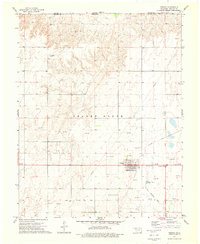
1973 · Forgan
USGS Topo · 1:24,000

1973 · Turpin East
USGS Topo · 1:24,000

1973 · Beaver
USGS Topo · 1:24,000
1973 · Beaver NW
USGS Topo · 1:24,000
1973 · Turpin NE
USGS Topo · 1:24,000