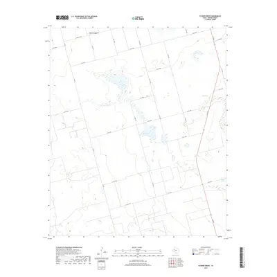
2019 Map of Flower Grove
USGS Topo · Published 2019About this map
Three Leagues occupies the northern expanse of this West Texas landscape, an area defined by its arid basins and vital mineral springs. This 2019 survey captures the essential hydrography of the Llano Estacado, where Alkali Lake sits at the center of a drainage network that supported early ranching and travel. The presence of Soda Springs to the northeast and Sulphur Springs in the southeast highlights the importance of localized water sources in a region dominated by a precise grid of county roads. These road networks, such as Fm 829 and Fm 2002, follow the geometric parceling typical of the Permian Basin's agricultural and industrial development. For those tracing the evolution of Martin County, the map provides a clear record of the intersection between historic spring locations and modern transportation corridors like Farm Rd 2002-E.
Find a feature on this map
23 named features on this map. Tap any name to fly to it.
Don’t see what you’re looking for? This feature index may not catch every label — zoom into the map to look around manually.
Map Details
Editions of this 2019 Flower Grove Map
This is the sole edition of this map. No revisions or reprints were ever made.
Other maps of this area

1954 · Hobbs
USGS Topo · 1:250,000

1954 · Big Spring
USGS Topo · 1:250,000

1958 · Big Spring
USGS Topo · 1:250,000

1958 · Hobbs
USGS Topo · 1:250,000

1966 · Wolcott Ranch
USGS Topo · 1:24,000

1966 · Merrick
USGS Topo · 1:24,000

1966 · Lenorah West
USGS Topo · 1:24,000

1966 · Flynt Ranch
USGS Topo · 1:24,000

1966 · Flower Grove
USGS Topo · 1:24,000
1966 · Lenorah East
USGS Topo · 1:24,000