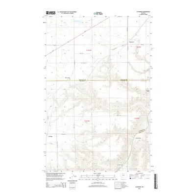
2014 Map of Floweree
USGS Topo · Published 2014About this map
The Missouri River cuts through the southeastern corner of this landscape, where the high plains of Central Montana are deeply incised by a series of dramatic coulees. This 2014 survey documents the agricultural and transportation networks of the borderlands between Chouteau and Cascade counties, centered on the small grain-elevator settlement of Floweree. The community is situated along Us-87 and the former path of Old Highway Rd, serving as a focal point for the surrounding dryland farms and ranches. To the southwest, the community of Portage is connected by a network of rural roads such as S Portage Rd and E Portage Rd. The terrain is defined by drainage features like Ryan Coulee and Widow Coulee, which lead toward the river valley. Family names and local history are reflected in routes like Myers Trl, Lewis Trl, and Rominger Ln, marking the modern footprint of long-established landholdings.
Find a feature on this map
27 named features on this map. Tap any name to fly to it.
Don’t see what you’re looking for? This feature index may not catch every label — zoom into the map to look around manually.
Map Details
Editions of this 2014 Floweree Map
This is the sole edition of this map. No revisions or reprints were ever made.
Other maps of this area

1886 · Great Falls
USGS Topo · 1:250,000

1890 · Fort Benton
USGS Topo · 1:250,000

1892 · Fort Benton
USGS Topo · 1:250,000

1897 · Fort Benton
USGS Topo · 1:250,000

1948 · Portage
USGS Topo · 1:62,500

1949 · Portage
USGS Topo · 1:62,500

1950 · Dent Bridge
USGS Topo · 1:62,500

1953 · Carter
USGS Topo · 1:24,000

1954 · Great Falls
USGS Topo · 1:250,000

1954 · Lander Crossing
USGS Topo · 1:24,000