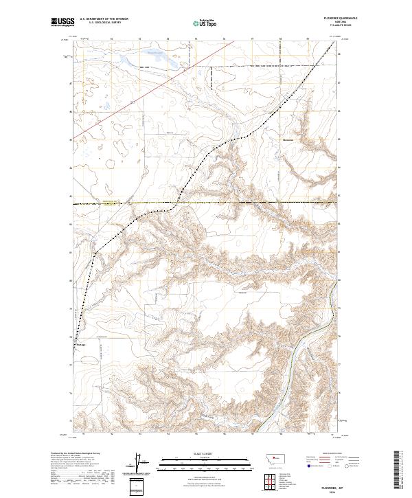
2024 Map of Floweree
USGS Topo · Published 2024About this map
The Missouri River winds through the southeastern corner of this map, carving a deep valley that defines the local topography. Atop the northern plateau, the settlement of Floweree serves as a focal point for the surrounding grain-growing region, supported by the Bnsf rail line. The landscape is deeply incised by multiple drainage features including Huntley Coulee and Ryan Coulee, which create a complex network of ridges and ravines leading toward the river. This area marks the transition between the flat upland prairies and the broken Missouri River brakes. Near the southern edge, the small settlement of Portage is situated along Portage Coulee Rd, historically significant as it relates to the Great Falls of the Missouri. Local travel is facilitated by a grid of rural routes such as Floweree Rd and Portage Rd, while Floweree Lake provides a notable water feature on the northern plains.
Find a feature on this map
23 named features on this map. Tap any name to fly to it.
Don’t see what you’re looking for? This feature index may not catch every label — zoom into the map to look around manually.
Map Details
Editions of this 2024 Floweree Map
This is the sole edition of this map. No revisions or reprints were ever made.
Other maps of this area

1886 · Great Falls
USGS Topo · 1:250,000

1890 · Fort Benton
USGS Topo · 1:250,000

1892 · Fort Benton
USGS Topo · 1:250,000

1897 · Fort Benton
USGS Topo · 1:250,000

1948 · Portage
USGS Topo · 1:62,500

1949 · Portage
USGS Topo · 1:62,500

1950 · Dent Bridge
USGS Topo · 1:62,500

1953 · Carter
USGS Topo · 1:24,000

1954 · Great Falls
USGS Topo · 1:250,000

1954 · Lander Crossing
USGS Topo · 1:24,000