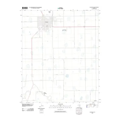
2010 Map of Floydada
USGS Topo · Published 2010About this map
Floydada serves as the focal point of this High Plains landscape, where the town's grid is bounded by a network of county and farm-to-market roads. The terrain is characterized by numerous small depressions and basins typical of the region, interspersed with infrastructure like the Floydada Municipal Airport. To the south, the White River winds through the territory near the Plains Assembly, creating a distinct contrast to the surrounding agricultural geometry. The survey provides a clear view of how rural life is structured along corridors such as Fm 1958 and Fm 312, leading toward smaller points of interest like Lakeview. The inclusion of local street names such as F Missouri St and Price St offers a granular look at the town's northern expansion during this period.
Find a feature on this map
20 named features on this map. Tap any name to fly to it.
Don’t see what you’re looking for? This feature index may not catch every label — zoom into the map to look around manually.
Map Details
Editions of this 2010 Floydada Map
This is the sole edition of this map. No revisions or reprints were ever made.
Other maps of this area

1954 · Lubbock
USGS Topo · 1:250,000

1954 · Plainview
USGS Topo · 1:250,000

1958 · Plainview
USGS Topo · 1:250,000

1965 · Lockney SE
USGS Topo · 1:24,000

1965 · Cone
USGS Topo · 1:24,000

1965 · Floydada
USGS Topo · 1:24,000

1965 · Lockney
USGS Topo · 1:24,000

1965 · Floydada SE
USGS Topo · 1:24,000

1965 · Boothe
USGS Topo · 1:24,000

1965 · Sandhill
USGS Topo · 1:24,000