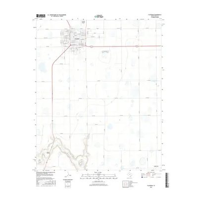
2016 Map of Floydada
USGS Topo · Published 2016About this map
Floydada serves as the primary hub of this Llano Estacado landscape, where the rectilinear grid of agricultural roads meets the dramatic southern incision of Blanco Canyon. The city street plan is detailed down to individual blocks, showing names like W Ross St and W Missouri St near the intersection of Farm Rd 784. Outside the municipal limits, the High Plains terrain is characterized by numerous small, seasonal basins and depressions that dot the farm ground between Co Rd 242 and Co Rd 270. To the south, the topography shifts abruptly as the White River carves into the caprock, creating the complex landforms of the canyon. This 2016 survey also identifies the outlying settlement of Lakeview and the Floydada Municipal Airport, documenting the modern infrastructure of Floyd County.
Find a feature on this map
75 named features on this map. Tap any name to fly to it.
Don’t see what you’re looking for? This feature index may not catch every label — zoom into the map to look around manually.
Map Details
Editions of this 2016 Floydada Map
This is the sole edition of this map. No revisions or reprints were ever made.
Other maps of this area

1954 · Lubbock
USGS Topo · 1:250,000

1954 · Plainview
USGS Topo · 1:250,000

1958 · Plainview
USGS Topo · 1:250,000

1965 · Lockney SE
USGS Topo · 1:24,000

1965 · Cone
USGS Topo · 1:24,000

1965 · Floydada
USGS Topo · 1:24,000

1965 · Lockney
USGS Topo · 1:24,000

1965 · Floydada SE
USGS Topo · 1:24,000

1965 · Boothe
USGS Topo · 1:24,000

1965 · Sandhill
USGS Topo · 1:24,000