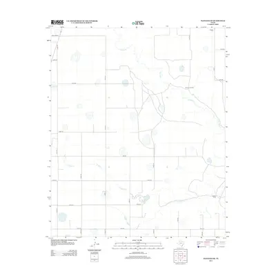
2012 Map of Floydada SE
USGS Topo · Published 2012About this map
White River and Crawfish Cr cut through this West Texas landscape, where the rural character of Crosby County is defined by wide-reaching cattle operations and a network of county roads. The terrain is marked by ephemeral water bodies such as Hancock Lake and Snow Lake, which reflect the hydrologic patterns of the Llano Estacado. Agricultural and ranching interests are anchored by landmarks like the Montgomery Ranch and Bridwell Ranch, showing the persistent land-use patterns of the early 21st century. In the northeast corner, Lakeview Cem serves as a localized point of interest for genealogists tracing family roots in this sparsely populated region. Connectivity is maintained by a grid of routes including Fm-651 and Ranch Road 54, which link these remote ranching outposts to the wider region.
Find a feature on this map
27 named features on this map. Tap any name to fly to it.
Don’t see what you’re looking for? This feature index may not catch every label — zoom into the map to look around manually.
Map Details
Editions of this 2012 Floydada SE Map
This is the sole edition of this map. No revisions or reprints were ever made.
Other maps of this area

1954 · Lubbock
USGS Topo · 1:250,000

1965 · Cone
USGS Topo · 1:24,000

1965 · Floydada
USGS Topo · 1:24,000

1965 · Floydada SE
USGS Topo · 1:24,000

1965 · Boothe
USGS Topo · 1:24,000

1965 · Sandhill
USGS Topo · 1:24,000

1966 · Crosbyton
USGS Topo · 1:24,000

1966 · Mount Blanco
USGS Topo · 1:24,000

1967 · Ralls NE
USGS Topo · 1:24,000

1967 · Ralls
USGS Topo · 1:24,000