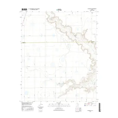
2016 Map of Floydada SE
USGS Topo · Published 2016About this map
Blanco Canyon dramatically cuts through the High Plains landscape of the Texas Panhandle, marking a sharp contrast to the surrounding agricultural grid. This area, spanning the border of Floyd Co and Crosby Co, is defined by the winding course of the White River, which has carved deep relief into the Caprock. Away from the canyon rim, the terrain is dotted with ephemeral wet features like Hancock Lake and Snow Lake, alongside numerous unnamed sinkholes and depressions characteristic of the Llano Estacado.
Find a feature on this map
29 named features on this map. Tap any name to fly to it.
Don’t see what you’re looking for? This feature index may not catch every label — zoom into the map to look around manually.
Map Details
Editions of this 2016 Floydada SE Map
This is the sole edition of this map. No revisions or reprints were ever made.
Other maps of this area

1954 · Lubbock
USGS Topo · 1:250,000

1965 · Cone
USGS Topo · 1:24,000

1965 · Floydada
USGS Topo · 1:24,000

1965 · Floydada SE
USGS Topo · 1:24,000

1965 · Boothe
USGS Topo · 1:24,000

1965 · Sandhill
USGS Topo · 1:24,000

1966 · Crosbyton
USGS Topo · 1:24,000

1966 · Mount Blanco
USGS Topo · 1:24,000

1967 · Ralls NE
USGS Topo · 1:24,000

1967 · Ralls
USGS Topo · 1:24,000