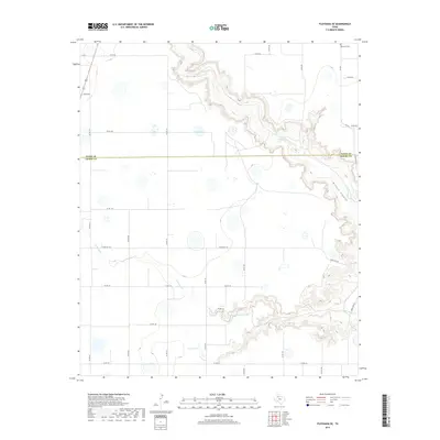
2019 Map of Floydada SE
USGS Topo · Published 2019About this map
Blanco Canyon cuts a dramatic path through the High Plains along the border of Floyd and Crosby Counties. This 2019 survey documents the serpentine course of the White River, which winds through the canyon floor while intermittent water bodies like Snow Lake and Hancock Lake dot the surrounding tableland. The landscape is defined by a rigid grid of county roads that abruptly meet the irregular, carved terrain of the canyon breaks. Evidence of local community life is found at the Lakeview Cem in the northeastern corner, near the intersection of FM 651 and Co RD 332. The drainage of Crawfish Cr further illustrates the complex hydrography of the Llano Estacado, where ranching and rural infrastructure, such as Ranch Rd 193, adapt to the significant elevation changes of the canyon system.
Find a feature on this map
29 named features on this map. Tap any name to fly to it.
Don’t see what you’re looking for? This feature index may not catch every label — zoom into the map to look around manually.
Map Details
Editions of this 2019 Floydada SE Map
This is the sole edition of this map. No revisions or reprints were ever made.
Other maps of this area

1954 · Lubbock
USGS Topo · 1:250,000

1965 · Cone
USGS Topo · 1:24,000

1965 · Floydada
USGS Topo · 1:24,000

1965 · Floydada SE
USGS Topo · 1:24,000

1965 · Boothe
USGS Topo · 1:24,000

1965 · Sandhill
USGS Topo · 1:24,000

1966 · Crosbyton
USGS Topo · 1:24,000

1966 · Mount Blanco
USGS Topo · 1:24,000

1967 · Ralls NE
USGS Topo · 1:24,000

1967 · Ralls
USGS Topo · 1:24,000