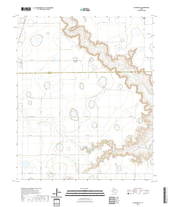
2022 Map of Floydada SE
USGS Topo · Published 2022About this map
Blanco Canyon cuts a distinctive path through the High Plains landscape along the boundary of Floyd and Crosby Counties. This 2022 survey illustrates the dramatic topography where the White River and its tributaries, including Crawfish Creek, have carved deep into the Caprock. The map shows a transition from the level agricultural fields of the Llano Estacado into the broken terrain of the canyon floor. Local landmarks like Lakeview Cem in the northeast corner and smaller water bodies such as Hancock Lake and Snow Lake provide points of reference within the network of county roads. The drainage patterns of Crawfish Cr reveal the erosional forces that continue to shape this portion of the Texas Panhandle, contrasting with the geometric precision of the surrounding ranch roads.
Find a feature on this map
29 named features on this map. Tap any name to fly to it.
Don’t see what you’re looking for? This feature index may not catch every label — zoom into the map to look around manually.
Map Details
Editions of this 2022 Floydada SE Map
This is the sole edition of this map. No revisions or reprints were ever made.
Other maps of this area

1954 · Lubbock
USGS Topo · 1:250,000

1965 · Cone
USGS Topo · 1:24,000

1965 · Floydada
USGS Topo · 1:24,000

1965 · Floydada SE
USGS Topo · 1:24,000

1965 · Boothe
USGS Topo · 1:24,000

1965 · Sandhill
USGS Topo · 1:24,000

1966 · Crosbyton
USGS Topo · 1:24,000

1966 · Mount Blanco
USGS Topo · 1:24,000

1967 · Ralls NE
USGS Topo · 1:24,000

1967 · Ralls
USGS Topo · 1:24,000