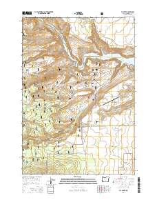
2014 Map of Fly Creek
USGS Topo · Published 2014About this map
The Metolius River carves a deep path through central Oregon, defining the dramatic topography of the Metolius Canyon. This high-desert landscape is a meeting point of federal lands, where the eastern boundary of the Deschutes National Forest joins the Crooked River National Grassland. The map documents a complex network of forest and ranch roads, such as Montgomery Rd and SW Prairie Farm Rd, which navigate the plateaus between deep drainages. Water management is central to the area's character, evidenced by the Box Canyon Reservoir and the reaching northern arms of Lake Billy Chinook. Geologic landmarks like Balanced Rocks and the Fly Creek Canyon illustrate the erosive power of the local waterways, while the 3 Rivers Recreation Area Airport and surrounding small airfield lanes indicate the modern recreational and residential footprint in this section of Jefferson County.
Find a feature on this map
38 named features on this map. Tap any name to fly to it.
Don’t see what you’re looking for? This feature index may not catch every label — zoom into the map to look around manually.
Map Details
Editions of this 2014 Fly Creek Map
This is the sole edition of this map. No revisions or reprints were ever made.
Other maps of this area

1926 · Bend
USGS Topo · 1:125,000

1927 · Mt. Jefferson
USGS Topo · 1:125,000

1928 · Madras
USGS Topo · 1:125,000

1929 · Bend
USGS Topo · 1:125,000

1929 · Three Sisters
USGS Topo · 1:125,000

1930 · Mt. Jefferson
USGS Topo · 1:125,000

1931 · Madras
USGS Topo · 1:125,000

1932 · Three Sisters
USGS Topo · 1:125,000

1955 · Bend
USGS Topo · 1:250,000

1957 · Bend
USGS Topo · 1:250,000