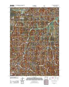
2011 Map of Fly Valley
USGS Topo · Published 2011About this map
Fly Valley and its surrounding drainage systems define this portion of Union County, Oregon, as documented in 2011. The landscape is structured by a complex network of forest roads and waterways, most notably the winding course of Sheep Creek and its tributary, East Sheep Creek. The area maintains its agricultural and pastoral character through the presence of the Vey Ranch, which includes the specialized Vey Sheep Ranch Airstrip in the northeastern quadrant of the map.
Find a feature on this map
15 named features on this map. Tap any name to fly to it.
Don’t see what you’re looking for? This feature index may not catch every label — zoom into the map to look around manually.
Map Details
Editions of this 2011 Fly Valley Map
This is the sole edition of this map. No revisions or reprints were ever made.
Other maps of this area

1901 · Sumpter
USGS Topo · 1:125,000

1951 · Desolation Butte
USGS Topo · 1:62,500

1953 · Pendleton
USGS Topo · 1:250,000

1955 · Canyon City
USGS Topo · 1:250,000

1956 · Pendleton
USGS Topo · 1:250,000

1959 · Canyon City
USGS Topo · 1:250,000

1965 · Limber Jim Creek
USGS Topo · 1:24,000

1965 · Marley Creek
USGS Topo · 1:24,000

1965 · Little Beaver Creek
USGS Topo · 1:24,000

1965 · Fly Valley
USGS Topo · 1:24,000