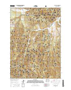
2017 Map of Fly Valley
USGS Topo · Published 2017About this map
Whitman National Forest dominates this section of Union County, Oregon, where the headwaters of several drainages begin their descent through the high country. The northern reach is defined by Fly Valley and the cooling waters of Fly Cr, while the eastern edge follows the winding course of the Grande Ronde River. This landscape is primarily a remote working forest, evidenced by the extensive network of National Forest development roads, such as Nat For Dev RD 51, which facilitate access to the timber and ranch lands.
Find a feature on this map
37 named features on this map. Tap any name to fly to it.
Don’t see what you’re looking for? This feature index may not catch every label — zoom into the map to look around manually.
Map Details
Editions of this 2017 Fly Valley Map
This is the sole edition of this map. No revisions or reprints were ever made.
Other maps of this area

1901 · Sumpter
USGS Topo · 1:125,000

1951 · Desolation Butte
USGS Topo · 1:62,500

1953 · Pendleton
USGS Topo · 1:250,000

1955 · Canyon City
USGS Topo · 1:250,000

1956 · Pendleton
USGS Topo · 1:250,000

1959 · Canyon City
USGS Topo · 1:250,000

1965 · Limber Jim Creek
USGS Topo · 1:24,000

1965 · Marley Creek
USGS Topo · 1:24,000

1965 · Little Beaver Creek
USGS Topo · 1:24,000

1965 · Fly Valley
USGS Topo · 1:24,000