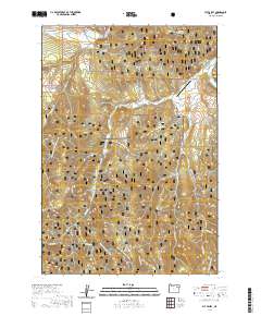
2020 Map of Fly Valley
USGS Topo · Published 2020About this map
Whitman National Forest dominates this landscape in the Blue Mountains, where high-elevation plateaus and deep drainages define the topography. The settlement of Fly Valley and the Vey Sheep Ranch Airport indicate the ranching history of this upland region, while the Grande Ronde River cuts through the northeast corner of the sheet. The area is heavily networked with seasonal recreation routes, including the Tin Trough-Tony Vey Snowmobile trail and the Big Ridge Ohv trail. Hydrological features are prominent throughout the forest, ranging from Warm Mineral Spring to Blue Spring and Johnson Rock Spring, which feed the headwaters of Fly Cr and Chicken Cr. The presence of these specific water sources and the 51 Road Snowmobile trail highlights a remote landscape managed for both timber and backcountry utility.
Find a feature on this map
26 named features on this map. Tap any name to fly to it.
Don’t see what you’re looking for? This feature index may not catch every label — zoom into the map to look around manually.
Map Details
Editions of this 2020 Fly Valley Map
This is the sole edition of this map. No revisions or reprints were ever made.
Other maps of this area

1901 · Sumpter
USGS Topo · 1:125,000

1951 · Desolation Butte
USGS Topo · 1:62,500

1953 · Pendleton
USGS Topo · 1:250,000

1955 · Canyon City
USGS Topo · 1:250,000

1956 · Pendleton
USGS Topo · 1:250,000

1959 · Canyon City
USGS Topo · 1:250,000

1965 · Limber Jim Creek
USGS Topo · 1:24,000

1965 · Marley Creek
USGS Topo · 1:24,000

1965 · Little Beaver Creek
USGS Topo · 1:24,000

1965 · Fly Valley
USGS Topo · 1:24,000