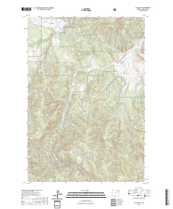
2024 Map of Fly Valley
USGS Topo · Published 2024About this map
Fly Valley sits within the high-elevation drainage of the Whitman National Forest in Union County, where the landscape is defined by an intricate network of mountain streams. This topography is characterized by the convergence of Fly Creek, Little Fly Creek, and Lookout Creek, which navigate the timbered slopes toward the Grande Ronde River. The presence of the Vey Sheep Ranch Airport suggests a reliance on aerial access in this remote portion of Oregon, likely supporting regional ranching or forest management operations. The area is a hub for backcountry recreation, mapped with specialized routes like the Tin Trough-Vey Snowmobile Trl and the Chicken Hill Ohv Trl. Natural water sources, including Warm Mineral Spring and Blue Spring, indicate the geothermal and hydrological variety found throughout the Sheep Creek watershed.
Find a feature on this map
26 named features on this map. Tap any name to fly to it.
Don’t see what you’re looking for? This feature index may not catch every label — zoom into the map to look around manually.
Map Details
Editions of this 2024 Fly Valley Map
This is the sole edition of this map. No revisions or reprints were ever made.
Other maps of this area

1901 · Sumpter
USGS Topo · 1:125,000

1951 · Desolation Butte
USGS Topo · 1:62,500

1953 · Pendleton
USGS Topo · 1:250,000

1955 · Canyon City
USGS Topo · 1:250,000

1956 · Pendleton
USGS Topo · 1:250,000

1959 · Canyon City
USGS Topo · 1:250,000

1965 · Limber Jim Creek
USGS Topo · 1:24,000

1965 · Marley Creek
USGS Topo · 1:24,000

1965 · Little Beaver Creek
USGS Topo · 1:24,000

1965 · Fly Valley
USGS Topo · 1:24,000