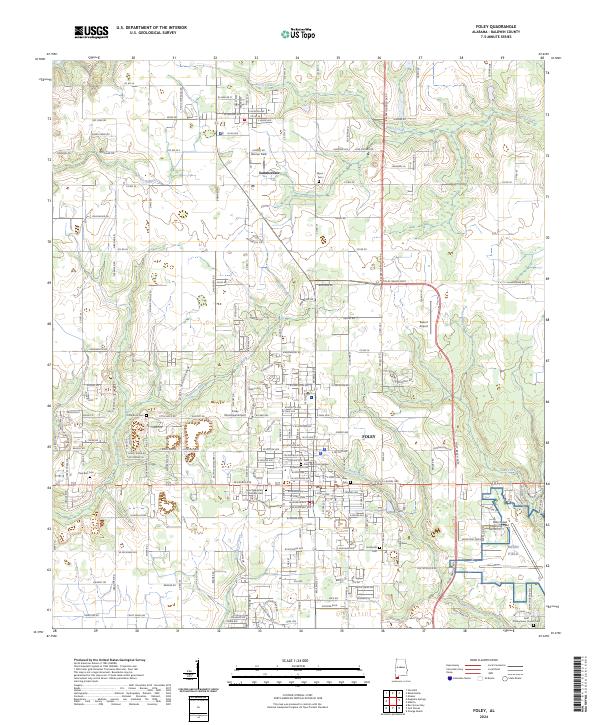
2024 Map of Foley
USGS Topo · Published 2024About this map
Foley and Summerdale anchor this coastal plain landscape in southern Alabama, where the dense residential grid of the town core transitions into a network of agricultural lands and aviation facilities. The presence of the Barin Naval Outlying Field and the Foley Municipal Airport underscores the region's long-standing connection to flight and military infrastructure. Several historic burial grounds, including Little Rock Cem and Wynn Cem, are distributed along the rural routes, providing important touchstones for local genealogists.
Find a feature on this map
113 named features on this map. Tap any name to fly to it.
Don’t see what you’re looking for? This feature index may not catch every label — zoom into the map to look around manually.
Map Details
Editions of this 2024 Foley Map
This is the sole edition of this map. No revisions or reprints were ever made.
Other maps of this area

1920 · Robertsdale
USGS Topo · 1:62,500

1921 · Bon Secour
USGS Topo · 1:62,500

1921 · Point Clear
USGS Topo · 1:62,500

1921 · Fairhope
USGS Topo · 1:62,500

1940 · Silverhill
USGS Topo · 1:31,680

1941 · Silverhill
USGS Topo · 1:31,680

1941 · Robertsdale
USGS Topo · 1:62,500

1941 · Foley
USGS Topo · 1:62,500

1941 · Weeks Bay
USGS Topo · 1:62,500

1941 · Fairhope
USGS Topo · 1:62,500