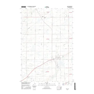
2016 Map of Foley
USGS Topo · Published 2016About this map
Foley serves as a primary hub of settlement in this part of Benton County, situated at the intersection of a well-defined grid of township roads and county highways. The landscape is characterized by a high density of wetlands and small water bodies, with Stony Brook and the Elk River drainage shaping the local topography. To the north, the small community of Gilman is anchored by the Saint Peter and Paul Parish Cem, while Parent marks the southwestern extent of the map's coverage. The eastern boundary is defined by the winding course of the Saint Francis River. This 2016 survey illustrates the persistent agricultural and rural residential patterns of central Minnesota, where local history is often preserved in sites like the Saint Johns Cem near the Foley town site.
Find a feature on this map
67 named features on this map. Tap any name to fly to it.
Don’t see what you’re looking for? This feature index may not catch every label — zoom into the map to look around manually.
Map Details
Editions of this 2016 Foley Map
This is the sole edition of this map. No revisions or reprints were ever made.
Other maps of this area

1948 · Pierz
USGS Topo · 1:62,500

1950 · Pierz
USGS Topo · 1:62,500

1950 · St. Cloud
USGS Topo · 1:62,500

1953 · Saint Cloud
USGS Topo · 1:250,000

1953 · Stillwater
USGS Topo · 1:250,000

1955 · Stillwater
USGS Topo · 1:250,000

1957 · Saint Cloud
USGS Topo · 1:250,000

1958 · Stillwater
USGS Topo · 1:250,000

1958 · Saint Cloud
USGS Topo · 1:250,000

1965 · Stillwater
USGS Topo · 1:250,000
Featured Places
- Gilman, MN
- Saint George Township, MN
- Gilmanton Township, MN
- Granite Ledge Township, MN
- Maywood Township, MN