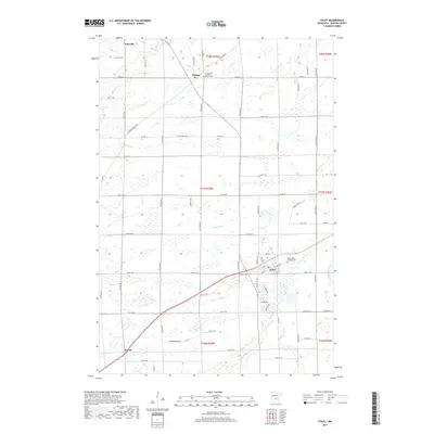
2019 Map of Foley
USGS Topo · Published 2019About this map
Foley serves as the primary hub in this central Minnesota landscape, where the town grid meets the meandering path of Stony Brook. The region is defined by its transition from agricultural fields to water-rich lowlands, particularly around the northern reaches of the Elk River near Jakeville. For genealogists and local historians, the map identifies specific community anchors such as the Saint Johns Catholic Cem in Foley and the Saint Peter and Paul Parish Cem located in the small settlement of Gilman. The southern edge of the quadrangle includes the hamlet of Parent, while the far eastern border is traced by the Saint Francis River. This map illustrates the contemporary balance of established township life and the natural wetland drainage patterns characteristic of Benton County.
Find a feature on this map
52 named features on this map. Tap any name to fly to it.
Don’t see what you’re looking for? This feature index may not catch every label — zoom into the map to look around manually.
Map Details
Editions of this 2019 Foley Map
This is the sole edition of this map. No revisions or reprints were ever made.
Other maps of this area

1948 · Pierz
USGS Topo · 1:62,500

1950 · Pierz
USGS Topo · 1:62,500

1950 · St. Cloud
USGS Topo · 1:62,500

1953 · Saint Cloud
USGS Topo · 1:250,000

1953 · Stillwater
USGS Topo · 1:250,000

1955 · Stillwater
USGS Topo · 1:250,000

1957 · Saint Cloud
USGS Topo · 1:250,000

1958 · Stillwater
USGS Topo · 1:250,000

1958 · Saint Cloud
USGS Topo · 1:250,000

1965 · Stillwater
USGS Topo · 1:250,000
Featured Places
- Gilman, MN
- Saint George Township, MN
- Gilmanton Township, MN
- Granite Ledge Township, MN
- Maywood Township, MN