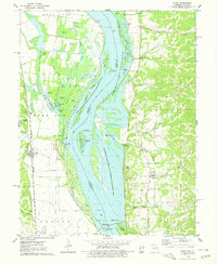
1975 Map of Foley
USGS Topo · Published 1978About this map
The Mississippi River dominates this mid-1970s landscape, serving as the border between Missouri and Illinois. On the Missouri side, the Burlington Northern railroad runs parallel to the river through the town of Foley. This area is characterized by a complex network of wetlands and sloughs, including Oasis Lake, Kings Lake, and Swan Pond, much of which is managed within the Mark Twain National Wildlife Refuges.
Find a feature on this map
81 named features on this map. Tap any name to fly to it.
Don’t see what you’re looking for? This feature index may not catch every label — zoom into the map to look around manually.
Map Details
Editions of this 1975 Foley Map
This is the sole edition of this map. No revisions or reprints were ever made.
Other maps of this area

1903 · O'Fallon
USGS Topo · 1:125,000

1930 · Hardin
USGS Topo · 1:62,500

1931 · Brussels
USGS Topo · 1:62,500

1934 · Elsberry
USGS Topo · 1:48,000

1934 · Hardin
USGS Topo · 1:62,500

1938 · Hardin
USGS Topo · 1:62,500

1939 · Brussels
USGS Topo · 1:62,500

1941 · Troy
USGS Topo · 1:62,500

1942 · Elsberry
USGS Topo · 1:62,500

1943 · Brussels
USGS Topo · 1:62,500