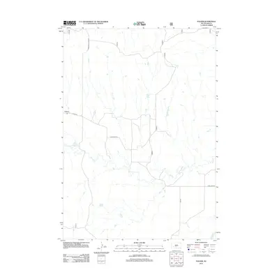
2012 Map of Folsom
USGS Topo · Published 2012About this map
Folsom serves as the primary focal point of this western South Dakota landscape, situated at the junction of Co Hwy-924 and the Farmingdale-Folsom Rd. The terrain is defined by the winding course of Spring Cr, which meanders across the central and southern portions of the quadrangle before eventually meeting the Cheyenne River in the southeast corner. The road network, including Spring Creek Rd and River Rd, follows the natural contours of the drainage systems, reflecting the typical rural prairie development pattern where infrastructure is closely tied to water sources. This 2012 survey illustrates a sparse settlement pattern characteristic of the region, where wide distances separate the community of Folsom from the surrounding river plains.
Find a feature on this map
7 named features on this map. Tap any name to fly to it.
Don’t see what you’re looking for? This feature index may not catch every label — zoom into the map to look around manually.
Map Details
Editions of this 2012 Folsom Map
This is the sole edition of this map. No revisions or reprints were ever made.
Other maps of this area

1951 · Red Shirt
USGS Topo · 1:24,000

1951 · Heutmacher Table
USGS Topo · 1:24,000

1951 · Red Shirt NE
USGS Topo · 1:24,000

1953 · Caputa
USGS Topo · 1:24,000

1953 · Folsom
USGS Topo · 1:24,000

1953 · Caputa NE
USGS Topo · 1:24,000

1953 · Caputa SW
USGS Topo · 1:24,000

1954 · Creston
USGS Topo · 1:24,000

1954 · Scenic SW
USGS Topo · 1:24,000

1955 · Hot Springs
USGS Topo · 1:250,000