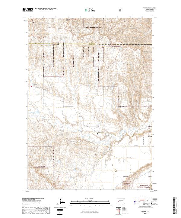
2021 Map of Folsom
USGS Topo · Published 2021About this map
Folsom serves as the central settlement point in this southwestern South Dakota landscape, positioned along the edge of the Buffalo Gap National Grassland. The area's agricultural and rural character is defined by the drainage patterns of Spring Cr and Elkhorn Draw, while distinctive geological markers like the Railroad Buttes and Phiney Flat provide topographic context. Local history is anchored at the Folsom Cem, situated near a significant tract identified as the Farm Service Agency Interest of South Dakota. Transportation in the region is established by a network of local routes including the Farmingdale-Folsom Rd and Lower Spring Creek Rd, which connect the scattered homesteads and public lands of Custer and Pennington counties.
Find a feature on this map
19 named features on this map. Tap any name to fly to it.
Don’t see what you’re looking for? This feature index may not catch every label — zoom into the map to look around manually.
Map Details
Editions of this 2021 Folsom Map
This is the sole edition of this map. No revisions or reprints were ever made.
Other maps of this area

1951 · Red Shirt
USGS Topo · 1:24,000

1951 · Heutmacher Table
USGS Topo · 1:24,000

1951 · Red Shirt NE
USGS Topo · 1:24,000

1953 · Caputa
USGS Topo · 1:24,000

1953 · Folsom
USGS Topo · 1:24,000

1953 · Caputa NE
USGS Topo · 1:24,000

1953 · Caputa SW
USGS Topo · 1:24,000

1954 · Creston
USGS Topo · 1:24,000

1954 · Scenic SW
USGS Topo · 1:24,000

1955 · Hot Springs
USGS Topo · 1:250,000